

I've created my first map/scenario of the NY/Canada region using the fantastic mapgen.exe
It's highly stylised and flat for easy gameplay e.g. exaggerted island size for NY and Montreal, fictional mountains.
I'd be grateful for any tips for increased accuracy.
I used Google Earth to get an image and manipulated into a Grayscale 384x384 image with Paintshop, attached. I painted the land mass grey and mountains with lighter colours as they get higher. I always end up with year round snow however - clearly my land height is too high (I had to set sea level at 20 in mapgen.exe just to see any water) but I don't know how to manipulate the land height. Is it to do with the input bmp image? I have chosen British climate btw.
As for naming towns and industries, does anyone have the problem with inserting a space into a two word name, e.g. "New York". Whenever I key spacebar, I don't get any response or the label defaults to its original state.
Thanks for your patience with a newbie.
BTW the scenario requires the US auto industry mod and US/Canada trains from AMItrains
First Map -New York and Canada [WIP] - grateful for any tips
Moderator: Locomotion Moderators
First Map -New York and Canada [WIP] - grateful for any tips
- Attachments
-
- NYRegionindustrycomplete.zip
- Map/scenario zipped
- (128.23 KiB) Downloaded 348 times
-
- Mapgen Input Image originally in bmp format
- Grayscale Input.jpg (145.05 KiB) Viewed 3082 times
-
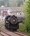
- NY Canada Region.jpg
- Screenshot
- (419.1 KiB) Downloaded 243 times
Last edited by benjones on 08 Oct 2006 20:04, edited 2 times in total.
-
Train-a-Mania
- Tycoon

- Posts: 2838
- Joined: 02 Mar 2006 22:56
- Location: Some town in Pennsylvania
- Contact:


Now the pic's been shown 3 times more 
My Scenarios:
Archipiélago Hermoso (Latest Release: Version 3.2)
Turnpike Falls (Latest Release: Version 0.91)
Who is online
Users browsing this forum: No registered users and 15 guests