Built a new scenario in the past month. It is a heightmap-based 1024x1024 map of Pittsburgh, PA and the region surrounding it (some miles of each the Allegheny, Ohio, and Monongehela valleys). All important towns and cities are in place and the map is covered by a crude road network. Several industries have also been placed, approximately where in reality you would find industries of these types, but industry placement in general is rather freelanced.
NewGRFs used:
- Canal Graphics
- ECS Industry Vectors (Town, Basic, Agri., Chem., Constr., Houses, Machinery, Wood) beta 5 each
- Electr. Rails
- North Am. Roads Set 1.0a
- North Am. City Set 1.0
- UK Town Set
Start Year is set to 1820 (!), feel free to edit this
Built in v1.04 of OTTD.
Recommended to be used with NARS, Generic Road Vehicles (eGRVTS), the Canadian Stations and the Ind. Stations Renewal, FiSH & Sailing Ships (big rivers everywhere!), and more to your liking.
Note, I usually play in a sort of sandbox mode, using the money cheat to place new industries when old (unserviced) ones go bust, so this map maybe reflects this playing style. It'll be a tough job to keep all the steel mills serviced without cheating at the beginning.
OK, enough said.
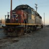
- screenshot#3.png (47.43 KiB) Viewed 350 times
Cheers!
Michael
PS: The GeoTiff came from the USGS Seamless Server. I also have a larger map area available (deeper into the valleys of the three rivers, suitable for a 2048*2048), if anyone is interested in the heightmap BMPs just let me know!