Blue Beetle's Maps

Got a nice scenario or saved game for Locomotion? Post it here!

Moderator: Locomotion Moderators

bluebeetle
Chairman
Chairman
Posts: 784
Joined: 06 Jan 2008 22:14
Location: Toronto, Canada

Blue Beetle's Maps

Post by bluebeetle »

From Trains Magazine December 2008:

No Place for Man, beast ... or train

"Across Ontario's Canadian Shield winter offers no mountain majesties, just cold, blowing snow. But to really feel the pain of the train crews, you would have to be here three weeks earlier. A carload freight from Winnipeg had spilled 17 cars between Pays Plat and Gravel, in one of the regions most inaccessible and inhospitable locales. Two of those cars, including paper pulp, lay partially submerged in icy lake superior. It took CP three days to reopen the line and they left the cars on the ground, including the two in the lake, to pick up three months later in the spring."

Image


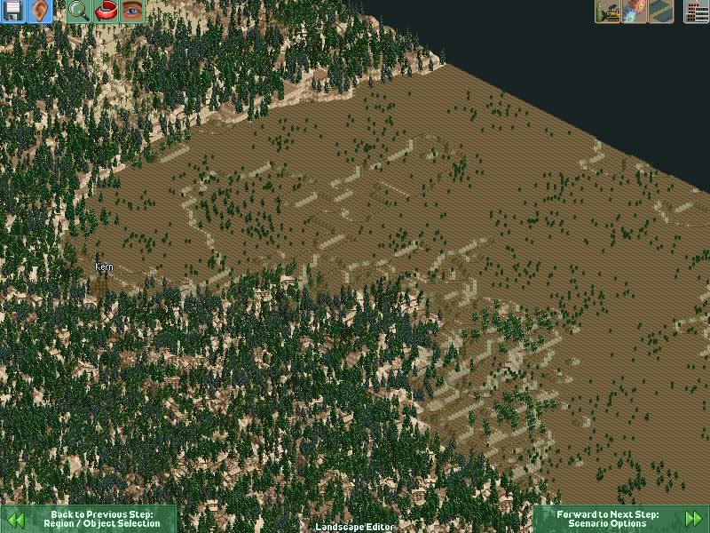
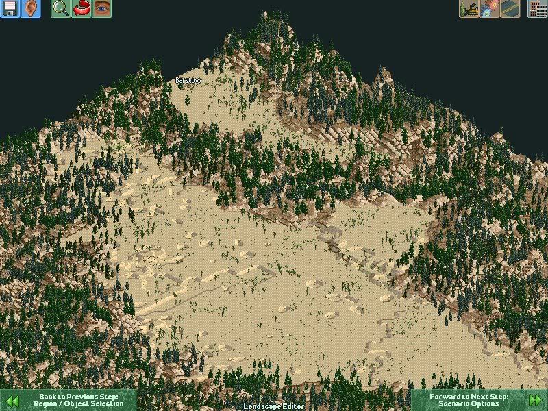
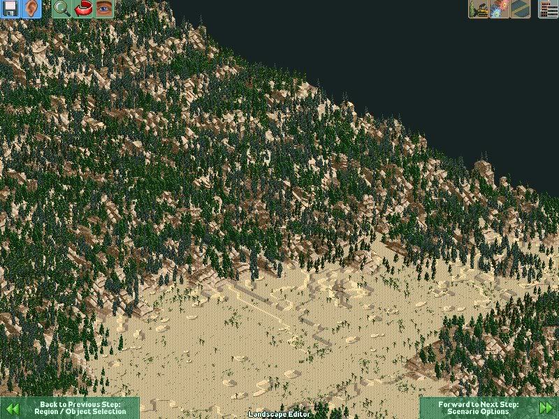
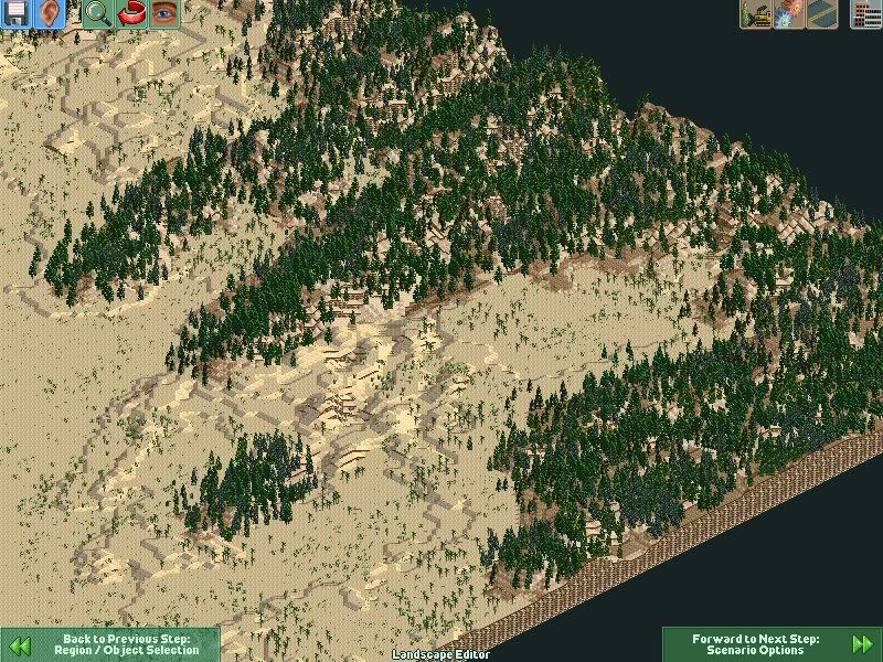
this area located between Thunder Bay and White river Ontario is the second hardest place for CP to build, maintain and travel. All their Vancouver - Montreal travels through here, so it is very busy, up to 30 trains can travel through here a day, including via trains. the only way to go around the lake in this area is right off the shore, the hills/mountains to the north make the grade too tough. And the only route passable to the north CN grabbed. So this map is developed that you must build on the shore to get around the lake. this version of the map needs provo (plastik's) to be installed.

Image
Image
Image
Image
Attachments
North Shore of Lake Superior.rar
(396.27 KiB) Downloaded 619 times
Last edited by bluebeetle on 08 Dec 2008 16:39, edited 8 times in total.
Image
bluebeetle
Chairman
Chairman
Posts: 784
Joined: 06 Jan 2008 22:14
Location: Toronto, Canada

Re: Canadian Pacific North Shore of Lake Superior

Post by bluebeetle »

here is some more images:

Image

Image

Image

Image

Image

Image

Image

Image

Image
Image
User avatar
rdrdrdrd
Tycoon
Tycoon
Posts: 1423
Joined: 09 Mar 2008 15:38
Location: Virginia

Re: Canadian Pacific North Shore of Lake Superior

Post by rdrdrdrd »

Nice, hand made?
May the force be with you.
For little boys, three things reign as supreme attention-keepers: tanks, heavy construction equipment, and trains, we all know why where here.

"Computer games don't affect kids; I mean if Pac-Man affected us as kids, we'd all be running around in darkened rooms, munching magic pills and listening to repetitive electronic music."

Image
bluebeetle
Chairman
Chairman
Posts: 784
Joined: 06 Jan 2008 22:14
Location: Toronto, Canada

Re: Canadian Pacific North Shore of Lake Superior

Post by bluebeetle »

rdrdrdrd wrote:Nice, hand made?
thank u, yep, took me a few days.

i tried to get as much detail as i could on the shore lines.
Image
User avatar
Plastikman
Tycoon
Tycoon
Posts: 3941
Joined: 24 Dec 2005 03:14

Re: Canadian Pacific North Shore of Lake Superior

Post by Plastikman »

bluebeetle wrote: this version of the map is mod free, the next one will be modded.
hate to tell you...

--- Cliffs ---
LSIRON : LSIRON.dat


--- Ground ---
IRONAREA : Ironarea.dat
SALTFLAT : SALTFLAT.dat


--- Bridges ---
BRDGARCH : brdgarch.dat
BRDGEART : BRDGEART.dat
FLYOVER : flyover.dat


looks like you had the provo map installed....
North American sets and then some...
US SET Ver 3.1.0 updated ~ Amtrak Pack 3.1.0 ~ US Passenger/Metro Set 3.1.0 updated~ Auto Factory 2.6 ~ VIA Rail Pack ~ LTD ED1 Conrail Alcos ~ LTD ED2 NJ Transit ~ DBR E60 ~ TGV Duplex ~ Umbrella Corp. ~ Comboios de Portugal~ Dekosoft UP/BN/BNSF Sets ~ ICE // MegaPack = 1.0.3.
Image
Image
Image
My Trains are made from 100% recycled electrons!
bluebeetle
Chairman
Chairman
Posts: 784
Joined: 06 Jan 2008 22:14
Location: Toronto, Canada

Re: Canadian Pacific North Shore of Lake Superior

Post by bluebeetle »

Plastikman wrote:
bluebeetle wrote: this version of the map is mod free, the next one will be modded.
hate to tell you...

--- Cliffs ---
LSIRON : LSIRON.dat


--- Ground ---
IRONAREA : Ironarea.dat
SALTFLAT : SALTFLAT.dat


--- Bridges ---
BRDGARCH : brdgarch.dat
BRDGEART : BRDGEART.dat
FLYOVER : flyover.dat


looks like you had the provo map installed....
yeah i missed that, does that automatically include themselves when making a map. Because i don't want to uninstall provo, it rocks too much to do that. i will just make it require provo.
Image
bluebeetle
Chairman
Chairman
Posts: 784
Joined: 06 Jan 2008 22:14
Location: Toronto, Canada

Re: Blue Beetle's Maps

Post by bluebeetle »

Mount Shasta (Úytaahkoo , Karuk) or the "White Mountain" in English, a 14,179-foot (4,322 m)[6] stratovolcano, is the second-highest peak in the Cascade Range and the fifth highest peak in California. It is a member in the Cascade Volcanic Arc and is located in Siskiyou County, and has an estimated volume of 108 cubic miles (450 km³), making it the most voluminous stratovolcano of the Cascades.

Image

up video by mount shasta:
http://www.youtube.com/watch?v=AfBG6NplOYo

BNSF does run traffic on this line from time to time for track rights.

Rails Around Mount Shasta

Check out UP's line between Redding, California and Klamath Falls, with lots of BNSF diversion traffic. In addition the big boys, we see California, Oregon & Pacific at Black Butte, and the McCloud River steam excursion. High Tech diesels whining up and down the Sacramento River Canyon and through the Shasta National Forest.

http://www.railwayshop.com/dvd/shasta.html

You Will Need Plastik's Provo Installed already to play this map. No industries or challenges have been placed ont his map, i am leaving that up to you. But plastik's Dk U.P. and north american sets would be perfect for this map.

this is my first mapgen conversion. Mount Shasta in the middle was too tall for loco and i had to change the top to fit in the game.

Image
Image
Image
Image
Attachments
Mount Shasta.rar
(356.29 KiB) Downloaded 440 times
Image
bluebeetle
Chairman
Chairman
Posts: 784
Joined: 06 Jan 2008 22:14
Location: Toronto, Canada

Re: Blue Beetle's Maps *New Mount Shasta Map*

Post by bluebeetle »

Leadville was the most productive of all of the Colorado mining regions. Mining in the area began in 1859, first for gold and then two decades later for silver. Several of the Santa Fe's board of directors (along with President Strong) sought to capitalize on the need to supply the mining towns of Colorado and northern New Mexico with food, equipment, and other supplies. To that end, Santa Fe sought to extend its route westward from Pueblo along the Arkansas River, and through the Royal Gorge in 1877. Royal Gorge was a bottleneck along the Arkansas too narrow for both the Santa Fe and the Denver and Rio Grande Western Railroad to pass through, and there was no other reasonable access to the South Park area; thus, a race ensued to build rail access through the Gorge. Physical confrontations led to two years of armed conflict, essentially low-level guerrilla warfare between the two companies that came to be known as the Royal Gorge Railroad War. Federal intervention prompted an out-of-court settlement on February 2, 1880 in the form of the so-called "Treaty of Boston" wherein the D&RG was allowed to complete its line and lease it for use by the Santa Fe. The D&RG paid an estimated $1.4 million to Santa Fe for its work within the Gorge and agreed not to extend its line to Santa Fe, while the AT&SF agreed to forgo its planned routes to Denver and Leadville.

Also looking to the south, an initial outlay of $20,000 was authorized on February 26, 1878 for the construction of a rail line south from Trinidad in order to "..seize and hold Raton Pass." The location of the route was nearly as crucial to the venture's success as was the actual track construction. W. R. "Ray" Morley, a former civil engineer for the (D&RG) hired by the AT&SF in 1877, was given his first assignment to secretly plot a route through the pass (it was feared that any activity in the area would lead the D&RG to construct a narrow gauge line over the Pass). Additionally, Strong learned that the Southern Pacific Railroad (SP) had introduced legislation to block the Santa Fe's entry into New Mexico. Undaunted, Strong obtained a charter for the New Mexico and Southern Pacific Railroad Company and immediately sent A. A. Robinson to Raton Pass. From February to December of 1878 work crews struggled to build the line between La Junta and Raton, and the first Santa Fe train entered New Mexico on December 7.

After BN Merged with ATSF to form BNSF, the railroad tracks from Albuquerque to Stateline with colorado where sold to new mexico for use for rail runner. All trains where diverted to southern new mexico on the much flatter transcon mainline. But Amtrack will continue to use the route, begs the question with so many shortline railroads popping up these days will we see one lease this line from the state?

Raton Pass video's, not many offered on utube lol:
http://www.youtube.com/watch?v=3aiV2p2R ... re=related
http://www.youtube.com/watch?v=puAwYIxNiHk
http://www.youtube.com/watch?v=so-DyOJXJrk
http://www.youtube.com/watch?v=E-FAhXw0 ... re=related

You Will Need Plastik's Provo Installed already to play this map. This map has high grades on both sides of the pass starting at near trinidad and raton. play this one will not be easy, it will take extra engines to move the freights up the hills, and take longer to get from point a to point b. Plus Bittle necking can happen easily in the pass later on in the game when traffic start to pick up/ Pretty sure this map will be my next storyline.

i have included an no trees and one with trees map.

Image
Image
Image
Image
Attachments
Raton Pass (no Trees).rar
(186.71 KiB) Downloaded 399 times
Raton Pass (With Trees).rar
(472.78 KiB) Downloaded 505 times
Image
User avatar
Twiggy
Route Supervisor
Route Supervisor
Posts: 477
Joined: 23 Mar 2008 14:06
Location: Underneath the car...

Re: Blue Beetle's Maps *New ATSF Raton Pass Map*

Post by Twiggy »

BB, that looks awesome mate, you've done a top job. I'm definately going to start playing that one tonight!

regards
[WIP] QLD Sugar Cane Set
[WIP] Another Aussie project...
CanAm - This ride is unsuitable for pregnant women, children under the age of 16 and whimps.
bluebeetle
Chairman
Chairman
Posts: 784
Joined: 06 Jan 2008 22:14
Location: Toronto, Canada

Re: Blue Beetle's Maps *New ATSF Raton Pass Map*

Post by bluebeetle »

thank you :D
Image
User avatar
Owen-Alexander
Engineer
Engineer
Posts: 79
Joined: 19 Jun 2008 11:30
Location: Australia

Re: Blue Beetle's Maps *New ATSF Raton Pass Map*

Post by Owen-Alexander »

With the Raton Pass senario, do you have the UFO enabled since you have placed Roswell, New Mexico on the map
bluebeetle
Chairman
Chairman
Posts: 784
Joined: 06 Jan 2008 22:14
Location: Toronto, Canada

Re: Blue Beetle's Maps *New ATSF Raton Pass Map*

Post by bluebeetle »

Owen-Alexander wrote:With the Raton Pass senario, do you have the UFO enabled since you have placed Roswell, New Mexico on the map
HAHAHAHAHA i didn't think of that, i am gonna have to put the livestock farms too, so the ufo can carry cattle.
Image
User avatar
rdrdrdrd
Tycoon
Tycoon
Posts: 1423
Joined: 09 Mar 2008 15:38
Location: Virginia

Re: Blue Beetle's Maps *New ATSF Raton Pass Map*

Post by rdrdrdrd »

Are these modded?
(btw looks amazing)
May the force be with you.
For little boys, three things reign as supreme attention-keepers: tanks, heavy construction equipment, and trains, we all know why where here.

"Computer games don't affect kids; I mean if Pac-Man affected us as kids, we'd all be running around in darkened rooms, munching magic pills and listening to repetitive electronic music."

Image
bluebeetle
Chairman
Chairman
Posts: 784
Joined: 06 Jan 2008 22:14
Location: Toronto, Canada

Re: Blue Beetle's Maps *New ATSF Raton Pass Map*

Post by bluebeetle »

rdrdrdrd wrote:Are these modded?
(btw looks amazing)
thank you, just need the provo map. :D
Image
User avatar
rdrdrdrd
Tycoon
Tycoon
Posts: 1423
Joined: 09 Mar 2008 15:38
Location: Virginia

Re: Blue Beetle's Maps *New ATSF Raton Pass Map*

Post by rdrdrdrd »

Thanks
May the force be with you.
For little boys, three things reign as supreme attention-keepers: tanks, heavy construction equipment, and trains, we all know why where here.

"Computer games don't affect kids; I mean if Pac-Man affected us as kids, we'd all be running around in darkened rooms, munching magic pills and listening to repetitive electronic music."

Image
User avatar
rdrdrdrd
Tycoon
Tycoon
Posts: 1423
Joined: 09 Mar 2008 15:38
Location: Virginia

Re: Blue Beetle's Maps *New ATSF Raton Pass Map*

Post by rdrdrdrd »

Blue Betle, can you post your New Mexico Northern scenario as well?
May the force be with you.
For little boys, three things reign as supreme attention-keepers: tanks, heavy construction equipment, and trains, we all know why where here.

"Computer games don't affect kids; I mean if Pac-Man affected us as kids, we'd all be running around in darkened rooms, munching magic pills and listening to repetitive electronic music."

Image
bluebeetle
Chairman
Chairman
Posts: 784
Joined: 06 Jan 2008 22:14
Location: Toronto, Canada

Re: Blue Beetle's Maps *New ATSF Raton Pass Map*

Post by bluebeetle »

rdrdrdrd wrote:Blue Betle, can you post your New Mexico Northern scenario as well?
that wasn't my map, i just added on to it, it was the neveda map. unfortunately i accidently deleted it when i had to reinstall loco after i screwed it up about a week ago. :(
Image
User avatar
rdrdrdrd
Tycoon
Tycoon
Posts: 1423
Joined: 09 Mar 2008 15:38
Location: Virginia

Re: Blue Beetle's Maps *New ATSF Raton Pass Map*

Post by rdrdrdrd »

okay, but where can I download it?
May the force be with you.
For little boys, three things reign as supreme attention-keepers: tanks, heavy construction equipment, and trains, we all know why where here.

"Computer games don't affect kids; I mean if Pac-Man affected us as kids, we'd all be running around in darkened rooms, munching magic pills and listening to repetitive electronic music."

Image
bluebeetle
Chairman
Chairman
Posts: 784
Joined: 06 Jan 2008 22:14
Location: Toronto, Canada

Re: Blue Beetle's Maps *New ATSF Raton Pass Map*

Post by bluebeetle »

it's walters: http://www.tt-forums.net/viewtopic.php?f=39&t=31252

he put out an real nice B.C. map as well: http://www.tt-forums.net/viewtopic.php?f=39&t=31253

both really nice maps, a must for north american fans :D
Image
bluebeetle
Chairman
Chairman
Posts: 784
Joined: 06 Jan 2008 22:14
Location: Toronto, Canada

Re: Blue Beetle's Maps *New ATSF Raton Pass Map*

Post by bluebeetle »

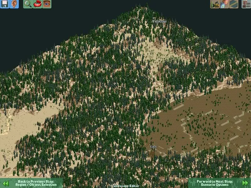
Tehachapi Pass (elevation 3793 ft/1156 m, location 35°06′08″ N 118°16′58″ W) is a mountain pass in southern California in the United States. It is located at the northeast end of the Tehachapi Mountains where they connect to the southern end of the Sierra Nevada mountains. The pass effectively marks the southern end of the Sierra. The pass connects the San Joaquin Valley to the Mojave Desert.

A group of businessmen in San Francisco, California, led by Timothy Phelps, incorporated the Southern Pacific Railroad Company in December 1865, to build a railroad between San Francisco, Los Angeles and San Diego, then build eastward to the eastern boundary of the state.

In July 1866, congress passed a bill authorizing the Southern Pacific Railroad Company, based in San Francisco, and the Atlantic and Pacific Railroad Company, based in St. Louis, to build a second transcontinental line from San Francisco to St. Louis. Both companies were to meet at the Colorado River near the 35th parallel.

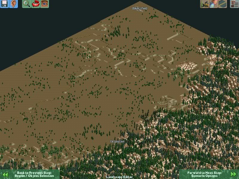
The Southern Pacific acquired the San Francisco & San Jose Railroad following authorization by the state legislature in March. Grading began on the extension southward at 4th Street in San Jose in April 1868, carried out by the Santa Clara & Pajaro Valley Railroad which had been incorporated in January. The line reached Gilroy in March 1869 and Hosister in July 1871.

The Southern Pacific was purchased by the directors of the Central Pacific, Leland Stanford, Collins P. Huntington, Mark Hopkins, and Charles Crocker in September 1868. The Atlantic & Pacific remained primarily in Missouri.

The Texas Pacific Railway was given a land grant by Congress to build along the 32nd parallel in 1871. Thomas Scott, President of the Texas Pacific, negotiated with San Diegans in 1872 to bring the line into their city.

The Central Pacific directors feared competition from the Texas Pacific Railway. Planning began on a Southern Pacific line through the southern part of the state on the way to the Colorado River, intending to beat Scott to the state line. Stanford and the rest of the directors decided not to construct the originally projected line from Tres Pinos to Visalia through the Pacheco pass due to the cost of construction and expense of operating over the mountains. The Central Pacific began building a more level line southward from Lathrop in December 1869, to connect with the Southern Pacific route. This line was built without the benefit of land grants or other government concessions. Trains reached Modesto in November 1870, Merced in January 1872, Sycamore (Herndon) in April 1872, Fresno in May 1972, and Goshen in August 1972. Practically all of the larger valley towns began as railroad towns along the line. Goshen, 146 miles south of Lathrop became the end of the Central Pacific line, as the line had reached the original survey for Southern Pacific through the San Jaoquin Valley.

The Southern Pacific line was placed in Service to Delano in July 1873. The SP's main construction efforts were focused in Los Angeles. Pressed for funds, the SP managed to obtain a subsidy in November 1872, from Los Angeles businessmen and residents who feared being left off a main line of a southern transcontinental road. City leaders gave their holdings in the Los Angeles & San Pedro Railroad to the Southern Pacific Railroad. In addition, the county provided a $602,000 cash subsidy to the Southern Pacific and rights of way to build lines to Pomona and Anaheim. A line was extended from the station on Alamedia Street to Naud Junction where one line continued 22 miles northward to San Fernando, and the other 29 miles eastward to Spadra.

Train No. 17 at Tehachapi Loop, C E Watkins photoConstruction in the San Joaquin Valley resumed in April 1874. In October 1874 the SP line reached Bakersfield. The tracks were constructed to Caliente in April 1875, at an elevation of 1,291 feet, which remained the southern terminus of the line for more than a year while more than 3000 American and Chinese men worked on the line through the Tehachapi Pass. At the pass, the railroad crosses over itself forming the Tehachapi Loop, at an elevation of 4,025 feet, a climb of 2,734 feet in 28 miles. A total of 19 tunnels were required. Trains reached the summit in July 1876. The Tehachapi Loop was hailed as one of the greatest engineering feats of its day.

As crews worked their way through the Tehachapi Mountains from the north, constructing the Tehachapi Loop, other crews were building the SP line out of San Fernando, which required digging a tunnel. Construction on the 6,966 foot long tunnel began in March 1875, the longest of its kind at the time, with workers digging round the clock from both ends. The tunnel headings met in July 1876. Tracks were soon heading northward into the canyon.

On September 5, 1876, at Lang Station, near Palmdale, Charles Crocker, President of the Southern Pacific Railroad drove a gold spike to complete the San Joaquin Valley line. Southern California and Los Angeles were linked with San Francisco and the East. A train from San Francisco reached Los Angeles the same day. Produce and manufactured goods could now be shipped more reasonably and quickly. A land boom began. The down side was that the directors of the Southern Pacific and Central Pacific had monopoly control of the major railroads in California, allowing them to control prices.

San Bernardino residents were also recruited for funds but declined. The SP line continued eastward from Los Angeles through a new town of Colton, seven miles south of San Bernardino. The line reached the Colorado River across from Fort Yuma, Arizona in 1877, the end of the distance the charter allowed. After a few political maneuvers, the line was extended into Arizona, reaching Tucson on March 20, 1880, and El Paso, Texas on May 19, 1881.

The Southern Pacific opened a line to Santa Barbara in 1887. The Coast Line was extended northward to connect with San Francisco in 1901.

SP opened the Los Angeles Junction Station, which boasted a hotel and dining room at Spring Street and North Broadway. In 1888, the SP moved to the Arcade Station at 5th and Central Streets, which was rebuilt on an adjoining site three decades later and called Central Station.

----------------------------------------------------------

version of the map needs provo (plastik's) to be installed.

This Map pretty much forces the player to lay track through the pass, to keep it challenging.

San Joaquin Valley
Image
Image

Mojave Desert

Image
Image
Image

The pass

Image
Attachments
Tehachapi (no trees).rar
(171.98 KiB) Downloaded 378 times
Tehachapi (With trees).rar
(509.02 KiB) Downloaded 482 times
Image
Post Reply

Return to “Locomotion Scenarios and Saved Games”

Who is online

Users browsing this forum: No registered users and 4 guests