Nuremberg and surroundings (Germany)
Posted: 28 Nov 2022 12:04
Hello!
Since the German tt-Forum is quite dead, unfortunately, i´ll present you my Franconia/Nuremberg/ Northern Bavaria Savestate.
Due to lack of terraforming skills, its an only-transport map.
I tried in Nuremberg and in some other villages to create some bus routes, but I set focus now in building the train routes.
As Nuremberg being the center, the Map should expand to Bamberg in the North, Bayreuth in the Nord-East, Regensburg in the East, Ingolstadt in the South-East, hopefully Augsburg in the South, but definitly till Donauwörth, Crailsheim, but Probably Aalen and Schwäbisch Hall in the South-West, Würzburg in the West and maybe Schweinfurt in the North-West.
It´ll cover every trainroute and trainstation in the Area, maybe, if im crazy enough, also every bus route and station.
I currently buld Franconia in the 2020s, but i´ll build more Scenarios:
1920s (Without any Electrification)
1930s (First Electrifications)
1940s (Time after the War with Nuremberg-Regensburg beeing electrificated)
1950s (Electrification on several routes)
1960s (TEEs are going on the run)
1970s (First InterCity Trains)
1980s (More frequent Commuter Services and a big number of tracks being decommissioned)
1990s (Reunition and the First ICEs are comming, also very colourful trains)
2000s (traffic Red is the dominant colour)
2010s (New S-Bahn routes for Nuremberg)
2030s (Deutschlandtakt)
Also i´ll buiid a Scenario in the current time, but without any decommissioned tracks and routes. So every route, that was buld in Franconia will be displayed. (Except maybe Nürnberg-Fürther Eisenbahn)
There is no final save state available yet, but I can show some screenshots:
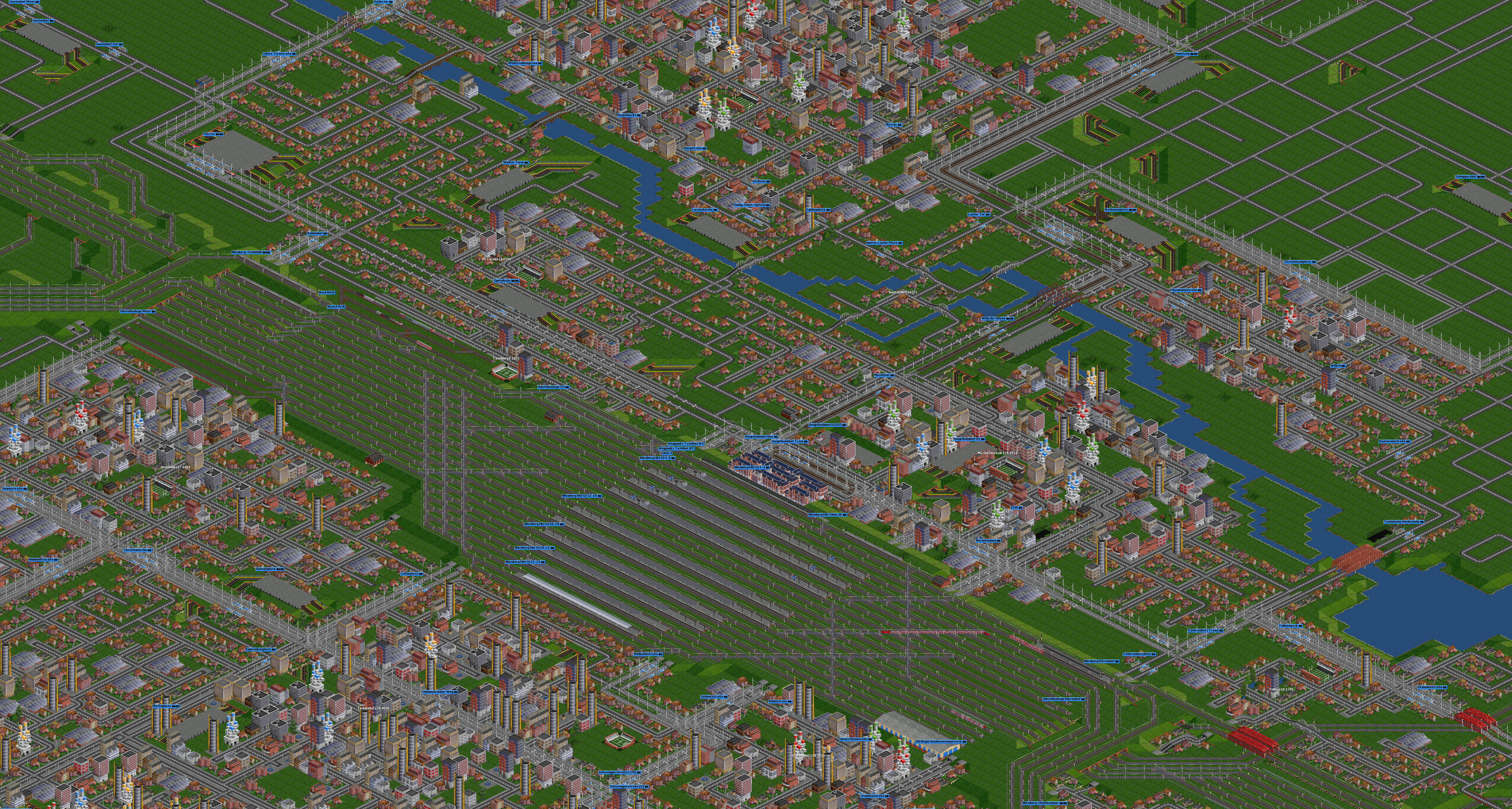
Nuremberg
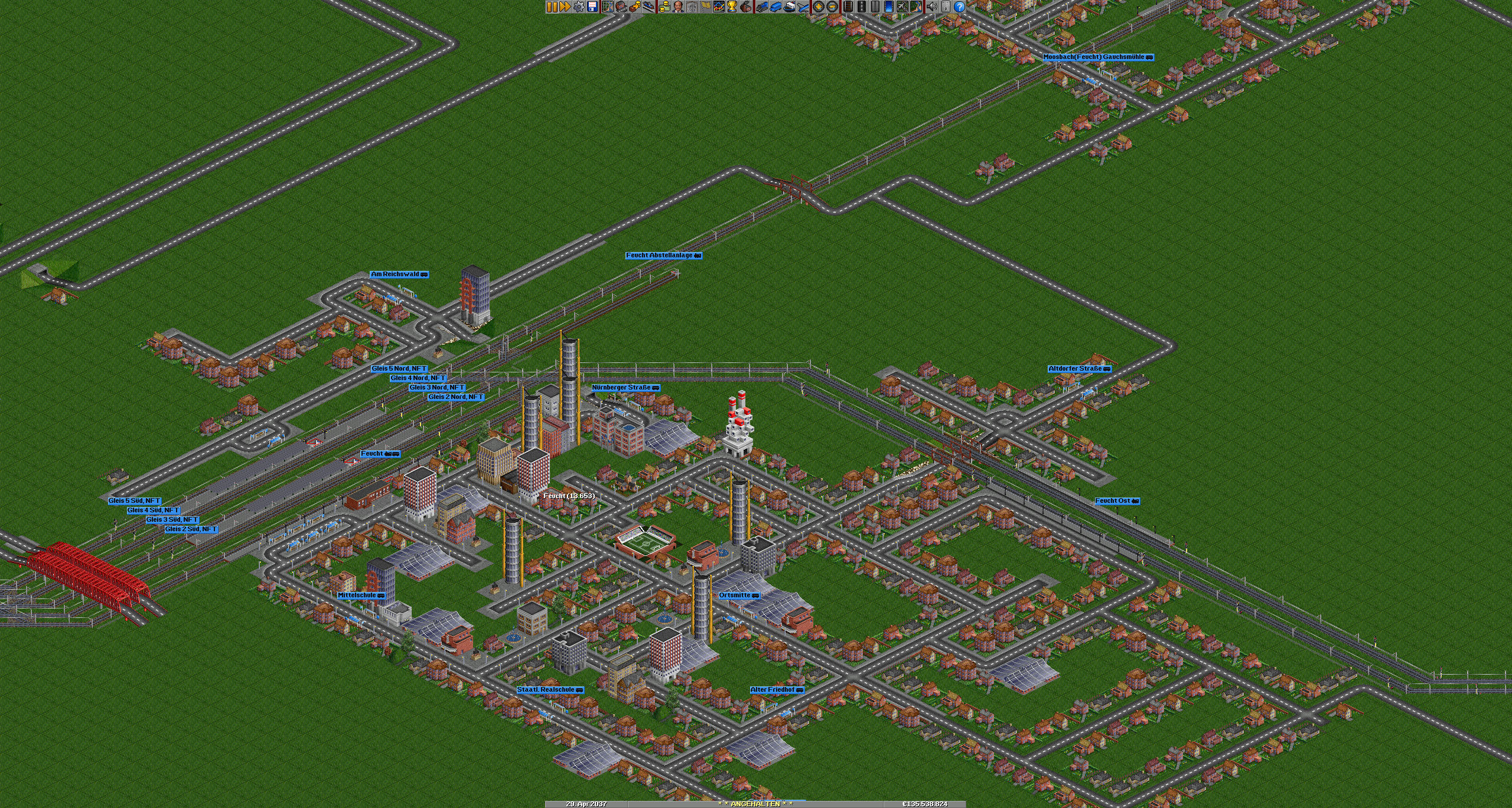
Feucht
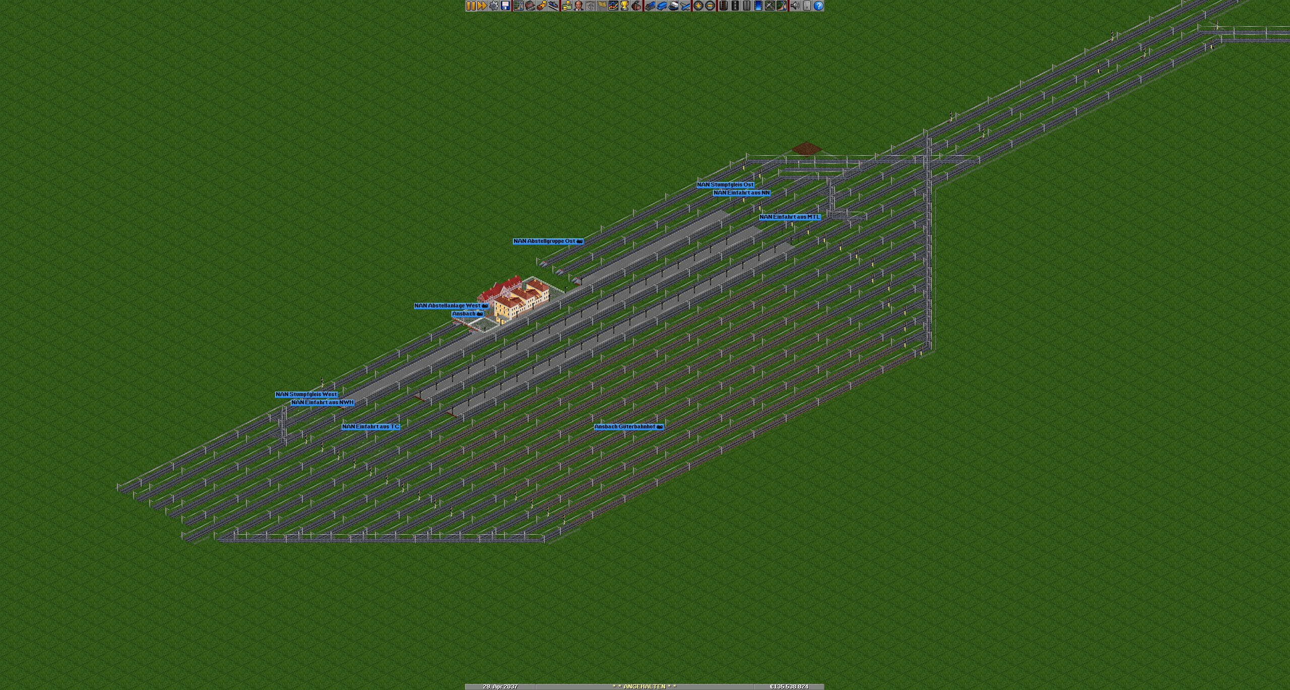
Ansbach
Since the German tt-Forum is quite dead, unfortunately, i´ll present you my Franconia/Nuremberg/ Northern Bavaria Savestate.
Due to lack of terraforming skills, its an only-transport map.
I tried in Nuremberg and in some other villages to create some bus routes, but I set focus now in building the train routes.
As Nuremberg being the center, the Map should expand to Bamberg in the North, Bayreuth in the Nord-East, Regensburg in the East, Ingolstadt in the South-East, hopefully Augsburg in the South, but definitly till Donauwörth, Crailsheim, but Probably Aalen and Schwäbisch Hall in the South-West, Würzburg in the West and maybe Schweinfurt in the North-West.
It´ll cover every trainroute and trainstation in the Area, maybe, if im crazy enough, also every bus route and station.
I currently buld Franconia in the 2020s, but i´ll build more Scenarios:
1920s (Without any Electrification)
1930s (First Electrifications)
1940s (Time after the War with Nuremberg-Regensburg beeing electrificated)
1950s (Electrification on several routes)
1960s (TEEs are going on the run)
1970s (First InterCity Trains)
1980s (More frequent Commuter Services and a big number of tracks being decommissioned)
1990s (Reunition and the First ICEs are comming, also very colourful trains)
2000s (traffic Red is the dominant colour)
2010s (New S-Bahn routes for Nuremberg)
2030s (Deutschlandtakt)
Also i´ll buiid a Scenario in the current time, but without any decommissioned tracks and routes. So every route, that was buld in Franconia will be displayed. (Except maybe Nürnberg-Fürther Eisenbahn)
There is no final save state available yet, but I can show some screenshots:
Nuremberg

Feucht

Ansbach
