Page 2 of 3
Re: Blue Beetle's Maps *New Tehachapi Pass Map*
Posted: 03 Dec 2008 04:03
by bluebeetle
over the next week i will be adding mods to my maps, so anybody can sit down and play them without having to set anything up.
Re: Blue Beetle's Maps *New Tehachapi Pass Map*
Posted: 03 Dec 2008 04:51
by Plastikman
something about the Tehachapi map is throwing me in a loop.. (bad pun intended) ....
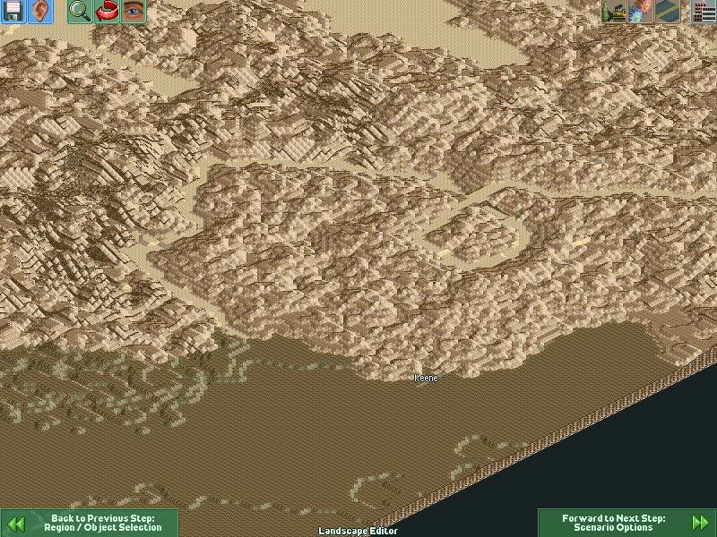
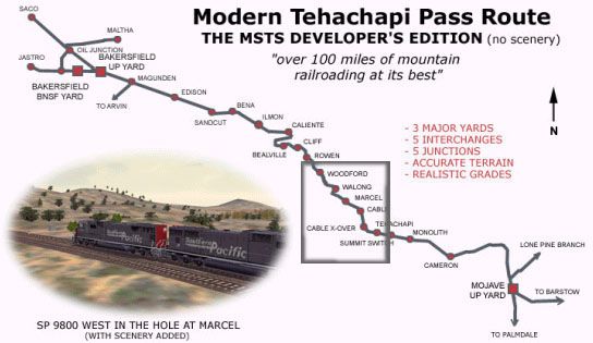
OK, i can see you meant it to route map from Bakersfield through Tehachapi , around mojave to Barstow.... basically a big"C".. i think you meant to put Keene on the map not Kern. (Kern is on the far side of Bakersfield i believe)..
Assuming You did mean Keene... uhh where is my Loop?.... I need my Loop! also assuming you meant Keene.. .. If so. You should have put Caliente there instead!! thats where the track doubles back on itself for the Horseshoe as it climbs on up to the loop..
Overall he map is pretty, .. i think maybe the pass needs a little more evelvation... carve out a bit of a valley in a gully of mountains?
IDK maybe I should play it before i stab you in the eye...... do you still have the greyscale?
Re: Blue Beetle's Maps *New Tehachapi Pass Map*
Posted: 03 Dec 2008 13:00
by rdrdrdrd
Nice, looks like some more Blue Beatle fun
Re: Blue Beetle's Maps *New Tehachapi Pass Map*
Posted: 03 Dec 2008 13:42
by bluebeetle
there is a few problems with the map:
1. wrong town name and placement
2. no loop
3. the grade of the pass has to be raised
4. too many trees
solutions:
building the the loop where the former town kern is placed. now this presents a few problems i make the loop too small it won't look right, too large won't look like a loop. the loop has a hill the middle of it and i am staying true to that. making the loop also solves another problem it raises the elevation in the pass. in the loop itself it is gonna be obvious where the track has to be laid no way around that.
will have a treeless version ready for this afternoon.
Re: Blue Beetle's Maps *New Tehachapi Pass Map*
Posted: 03 Dec 2008 16:18
by Xrufuian
Looks nice, except for some errors. How do I know this? I know the whole area like the back of my hand...
I can recognize the topography, you need a different greyscale. The current one has only the western half of the pass (topographic wise), the west side needs to be there. Mojave & Barstow aren't north of Tehachapi, they're east. You'll know because Tehachapi-Willow Springs Road isn't on your map.
I was planning a similar scenario, the only problem was that I haven't prepared the greyscale yet.
Re: Blue Beetle's Maps *New Tehachapi Pass Map*
Posted: 03 Dec 2008 17:09
by Plastikman
he has them laid out in a c shape or route style for more map within LoMo limits. that is how mine was done also.
mine was a bit more route map style..where there was water in "out of bounds" area. (similar to zimmlocks pen world or square map)
@beetle. take your time man... you picked one of the most popular train routes in the world. no matter what you do, it will be nitpicked by someone and LoMo cant make a perfect representation, we are aware of that. so far you have the basics down (mostly) right within limits..
Re: Blue Beetle's Maps *New Tehachapi Pass Map*
Posted: 03 Dec 2008 17:33
by bluebeetle
when i started the map i made the decision that bakersfield and barstow have to be the furtherest from one another (for passenger service, goods and so forth). going west to east as the real pass is not really feasible in locomotion, but making it in a C pattern was the best way to approach it. the mojave desert and San Joaquin Valley are the two lowest points on the map, both are pretty much surrounded by mountain ranges. placing tehachapi on top of the pass as an half way mark for the pass or close to it. now the problem is, how do i get people to use the pass and just build a tunnel across the mountain range in the middle, by placing an mountain range that is pretty very very expensive to build tunnels through.
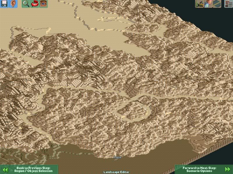
when the first map came out i was missing the loop and the elevation of the pass. i made the floor of the pass and the loop in sand and not rock so it is easier for people too see. the climb from bakersfield is gradual, but the climb from the otherside is steep towards the town of tehachapi.
Plastik is helping get some details ironed out on it, once he is happy with it i will release a tree version.
but as plastik said it is not really feasible in loco to have an exact map.
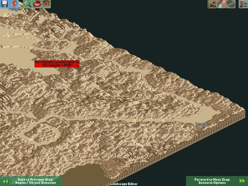
here are the changes, and more might change later today:
Re: Blue Beetle's Maps *New Tehachapi Pass Map*
Posted: 03 Dec 2008 17:44
by Plastikman
that's an interesting aproch... if thats double track i like it.. i would like to see the caliente horseshoe still. that's almost as important as the loop.. where loco are almost next to the tail of the train but up on the ridge above it.
Re: Blue Beetle's Maps *New Tehachapi Pass Map*
Posted: 03 Dec 2008 18:16
by bluebeetle
Plastikman wrote:that's an interesting aproch... if thats double track i like it.. i would like to see the caliente horseshoe still. that's almost as important as the loop.. where loco are almost next to the tail of the train but up on the ridge above it.
i am gonna add the caliente horseshoe between keene and the loop, plenty of room to work with there, i don't want to take anymore land from San Joaquin Valley due to it being the bread basket of california and will be for this map for the wheat farms and so forth.
there are a few choke points in the pass that i need to open up a little more, but 80% right now can be double tracked. the whole loop is designed for double tracking, and i left extra room at the town of tehachapi for the town to grow and for a station to be built.
I also want to work on the area around barstow, too hard to get into that valley.
Re: Blue Beetle's Maps *New Tehachapi Pass Map*
Posted: 03 Dec 2008 18:26
by The Tram man
Nice maps.
Re: Blue Beetle's Maps *New Tehachapi Pass Map*
Posted: 03 Dec 2008 21:17
by Plastikman
this is beta testing Ver2
Re: Blue Beetle's Maps *New Tehachapi Pass Map*
Posted: 03 Dec 2008 21:21
by Plastikman
more
Re: Blue Beetle's Maps *New Tehachapi Pass Map*
Posted: 03 Dec 2008 21:23
by bluebeetle
i need to round out those curves more then what they are and they will be perfect after that.
Re: Blue Beetle's Maps *New Tehachapi Pass Map*
Posted: 04 Dec 2008 05:22
by Plastikman
Well. I has started the same map a while back, but, since the beetle is so set on building it "right" (like flipping the loop once i noticed it went in reverse lol... )
I might add the "Toys" I had sitting around.
"toys" you ask?
Well I wont promise anything, one of the few items i found was this guy...

- Screenshot38.png (120.47 KiB) Viewed 3310 times

- Screenshot39.png (116.51 KiB) Viewed 3310 times
The terminus for the San Joaquin's service of Amtrak California. The Bakersfield Amtrak station.... just up the tracks from the old station.... (thats not it.. the small one is a canadian station)
It needs a new Baseplate... a little touch up..... but..... she is a working 4x2 station...
Edit: posted another shot of the latest beta
Re: Blue Beetle's Maps *New Tehachapi Pass Map*
Posted: 04 Dec 2008 08:45
by CRATSCH
wow guys!!....that´s amazing work!! can´t wait to play with all of these toys.
I had an idea last night with the engines directions because when you couple e.g. three engines the last one has the same direction as the first and that is not very common in real world so my idea was to take the flashing rear light or something with similar size and let it act like an engine. The result will be that you can´t see it but you can set your engines easily in all imaginable setups. E.g. if you put in in the front than you get long hood forward and so on.
Sorry for being off topic:)
Re: Blue Beetle's Maps *New Tehachapi Pass Map*
Posted: 04 Dec 2008 11:25
by bluebeetle
once the loop got flipped things really started falling into place, this morning i am gonna work on the pass between the town of tehachapi and the loop, and clean up some of the curve between the horsehoe and the loop so double track can be cleanly built.
Re: Blue Beetle's Maps *New Tehachapi Pass Map*
Posted: 04 Dec 2008 12:51
by Plastikman
bluebeetle wrote:once the loop got flipped things really started falling into place, this morning i am gonna work on the pass between the town of tehachapi and the loop, and clean up some of the curve between the horsehoe and the loop so double track can be cleanly built.
take a look at the last version i had sent you where in the leg from the the horse shoe to the loop...
i would like to see at least 1 more tunnel (the loop is tunnel 9 ughh) and i had chopped a bit of a ravine and a bridge to one side.... for a lot of the uphill run there is a "whoa f***" drop off to the left...
i have the Bakersfield UP station now... the f*** is 6x2.. i'm gonna see if i can change that. go 4x2 or 6x1..
i have an idea for the goal... make a set of warehouses or industries that 1 produces 1 type of goods (goods "A" for now) and Receives "goods B" and the other is the opposite. they would share the same slot as goods so you can run any goods car over the pass back and forth... give you a goal of moving goods A (we can call em exports , imports, California bound, etc i could care less).. make them have a long decay. they would pay "so-so" so you need to still run local freight/pass for money.
oh i thnk my camoflague piant is sort of nice for bits of the map...
edit: pffft ooops this was suposed to be PM.. lol hit the wrong button..... damn rdrdrdrdrdrdrd bumping it 3 sec later to block the delete button.....
Re: Blue Beetle's Maps *Tehachapi Pass Beta by Plastik & Beetle*
Posted: 04 Dec 2008 12:52
by rdrdrdrd
nice, very nice
Im going to have to post some screens myself
Re: Blue Beetle's Maps *Tehachapi Pass Beta by Plastik & Beetle*
Posted: 04 Dec 2008 15:42
by bluebeetle
"oh i thnk my camoflague piant is sort of nice for bits of the map..."
i agree, and we will shade it just like that. with very thin dusting of small bushes and trees. they have to be spread out and not bunched. i been looking at A LOT of real images of the pass, and vegetation is thin and very spread out.
latest beta has been sent to plastik, don't be surprised if more screen shot show up this afternoon. i rebuilt the pass to marcel, added the town of marcel. plus fine tuning between the loop and the horseshoe.
Re: Blue Beetle's Maps *Tehachapi Pass Beta by Plastik & Beetle*
Posted: 04 Dec 2008 16:42
by The Tram man
@Plastik: Where did you get that awsome station?