[OTTD] Winterwood Heights
Posted: 05 Feb 2022 11:36
Winterwood Heights is a 256x256 mountainous river scenario based in the classic arctic landscape style, with the vanilla OpenTTD game. It's an attempt to make a more realistic looking river valley with many smaller side valleys. My personal goal when playing this scenario is to let trains follow valleys and slowly move up the mountains, and to avoid terraforming too much. In the central part the river valley is narrow, while north and south, the river valley is wide and has many cities and farms. Towards the east is a high mountain, and a steep dry river valley runs just north of the mountain.
Current version is 2.64, with a bunch of improvements that came from playing it myself. Licensed under CC-BY-SA v3.0.
As you can see, I run OpenTTD with the original TTD graphics, I'm still loving it . One of my favourite scenarios is still the original TTD Scotland scenario, and that's why I've looked into ways of playing similarly detailed, small, and somewhat realistic maps. And last year I finally got motivated to build my own scenario!

Overview of the map.

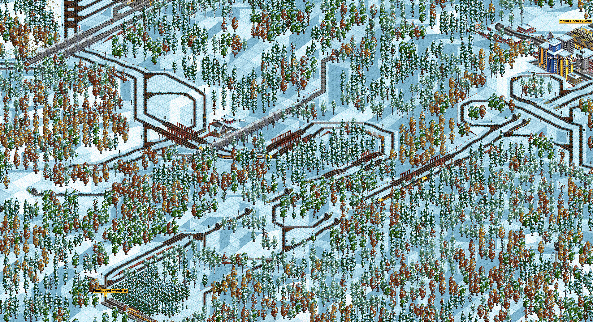
Detail of the map near the highest mountain of the map. On the top we see the dry valley, and on the bottom a less steep slope that is a potential route up the largest mountain.

Detail of the map near the side valley that leads to the largest city of the map.

The hilly nature of the map causes many challenges for accessing industries, if you do not want to go straight up to the mountain.
Endgame situation, where trains are taking many detours to slowly go up the largest mountain on the map.
P.S. I'm a newbie on these forums, so if I didn't do things right, let me know
Current version is 2.64, with a bunch of improvements that came from playing it myself. Licensed under CC-BY-SA v3.0.
As you can see, I run OpenTTD with the original TTD graphics, I'm still loving it
Overview of the map.
Detail of the map near the highest mountain of the map. On the top we see the dry valley, and on the bottom a less steep slope that is a potential route up the largest mountain.
Detail of the map near the side valley that leads to the largest city of the map.
The hilly nature of the map causes many challenges for accessing industries, if you do not want to go straight up to the mountain.
Endgame situation, where trains are taking many detours to slowly go up the largest mountain on the map.
P.S. I'm a newbie on these forums, so if I didn't do things right, let me know