Page 11 of 19
Re: Show us your network maps
Posted: 21 Jul 2011 18:14
by t_blast
Hi all,
Long-time lurker just turned mapmaker... I hope you like this effort.
It's very early days on the North Eastern Railway. The moneymakers (three coal and one wood/goods route) are not shown, because I'm mostly into passenger traffic. As it's only 1843, 13 years in, there's not that much passenger traffic out there, but it's building slowly and turning a decent profit in spite of the best efforts of my Planet 2-2-0s!
I'm really into 1980s British Rail and this is the style I'm hoping to emulate - a very anachronistic map style at the moment

Best,
Toni
Re: Show us your network maps
Posted: 21 Jul 2011 20:23
by Level Crossing
What program was used for that?
My submission:
Re: Show us your network maps
Posted: 21 Jul 2011 22:11
by t_blast
Hi Level Crossing,
Microsoft Visio. Plus a lot of pain and free time.
I was quite happy with the initial result, but now I'm wondering whether the map needs to show fast/stopping services (the London Underground Metropolitan Line on-train maps do, and it looks great) and also I may have overused the BR arrows a tiny bit...
Best,
Toni
Re: Show us your network maps
Posted: 29 Jul 2011 04:14
by darkequi
Hi there,
I've build a small transportation network, containing about 35 trains and 17 stations. to sum it all up, a nice junction.
I cannot do a screenshot because this network is too large to have it all on one screeny, so i did a transport network layout, mostly realistic.
hope you like it
greets
Re: Show us your network maps
Posted: 29 Jul 2011 11:26
by Ruskij
darkequi wrote:Hi there,
I've build a small transportation network, containing about 35 trains and 17 stations. to sum it all up, a nice junction.
I cannot do a screenshot because this network is too large to have it all on one screeny, so i did a transport network layout, mostly realistic.
hope you like it
greets
That's just great! Fortunately you are using it for transport business only, an average-everyday-passenger yould be lost
Re: Show us your network maps
Posted: 29 Jul 2011 13:32
by darkequi
That's just great! Fortunately you are using it for transport business only, an average-everyday-passenger yould be lost
thanks

was quite a lot of work, but creating the diagram was the hardest (since it is my first).
the reason for not transporting passengers in this junction is that there are no passengers in the nearby area. the only town is right of the south station where the goods are exchanged to.
but the junction can be used for later usage when the transportation network is about to grow. transfers from and to all directions are possible here.
Re: Show us your network maps
Posted: 02 Aug 2011 08:08
by Wasila
Not technically a network map, but I figured I'd post up some shots of my network links from the minimap (CargoDist). This map is the extra-large world map.
Europe here. In the west you can see the various routes emanating from London Heathrow, as well as mainline services stretching to Kiev.
South-eastern United States. The mainline track starts at New York and is seen here running to Denver, although it terminates at Los Angeles.
India here. The line in the west stretches to Tehran, which has links to New Delhi and Dacca, among others. Bangalore in the south has links to New Delhi via the main junction and Kanpur on a separate line.
Re: Show us your network maps
Posted: 02 Aug 2011 08:13
by darkequi
Im thinkin about a software that automatically creates such network layout diagrams as i provided 2 posts above.
i think you all would appreciate such kind of software?
Re: Show us your network maps
Posted: 02 Aug 2011 08:51
by Wasila
Yeah, that would be a good idea!
Re: Show us your network maps
Posted: 02 Aug 2011 09:07
by darkequi
actually i dont know anything about the openttd map design (except that there is some planing about changing the map data structure), so i would need someone who is able to extract some information (information about tiles, track type, track tile position and direction, inclination, stations, depots, signals, etc) from a savegame in any dataformat (xml/yaml/whatever).
maybe i should create a whole new topic for that ...
Re: Show us your network maps
Posted: 03 Aug 2011 08:28
by Jacko
You could just include it in the key or something,
like this:
Maglev
Monorail
Electrified Railway
Normal Railway
Re: Show us your network maps
Posted: 06 Aug 2011 11:29
by Pottsy
Here is my map of my yorkshire rail system (The small print- passenger services only. Some lines ommited
Re: Show us your network maps
Posted: 06 Aug 2011 13:48
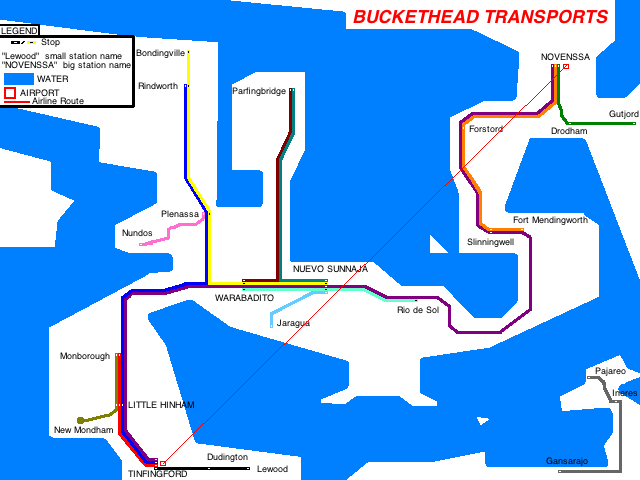
by buckethead
As shown on my screenshot topic:
Re: Show us your network maps
Posted: 08 Aug 2011 21:54
by hthhs
Nice maps, all!
So I decided to join in with this network map lark
attached is a poster for a subset of the routes in my current game. The relative placement of stations on it is approximately geographically accurate, and for reference the non-stop KX to Cambridge journey takes just under 1h10m in a Class 321.
Commuters are unhappy with the restrictions on carrying cycles on trains, but they're in place to alleviate the severe overcrowding on peak services. None of the stations on the map are capable of handling trains longer than 8 cars, and local authorities have refused permission to lengthen their platforms.
Re: Show us your network maps
Posted: 08 Aug 2011 22:18
by buckethead
Beautiful map!
Re: Show us your network maps
Posted: 09 Aug 2011 11:22
by Ruskij
That's really great work!
Re: Show us your network maps
Posted: 11 Aug 2011 21:22
by Rigil
Nice idea with the colors.
Re: Show us your network maps
Posted: 13 Aug 2011 15:28
by EXTspotter
Here is one I made in paint. I wish there was a better programme I could use that was free. Any ideas?
Re: Show us your network maps
Posted: 13 Aug 2011 22:21
by Level Crossing
If the bragging right for the express service is Gillingham to Elland, wouldn't the Gillingham - Elstree - Elland line be faster?
Re: Show us your network maps
Posted: 13 Aug 2011 22:32
by Pilot
Level Crossing wrote:If the bragging right for the express service is Gillingham to Elland, wouldn't the Gillingham - Elstree - Elland line be faster?
No, the Gillingham to Elstree train is an AEC Railcar (75 mph) and the Elstree to Elland train is most likely the Southern EMU (70 mph (I think)) or the Met-Camm (Metro - Cammell) EMU (75 mph)