Page 6 of 7
Re: Virtual Netherlands
Posted: 18 Jun 2022 15:40
by bef123
Thanks

Yes, it takes quite a lot of time to make area for one screenshot. Sometimes around one hour and sometimes around two hours, it depends how I want make realistic are compare to real one.
German connection....yes I'm thinking about linking east Netherlands with Ruhr Area by Betuwe Route but these are long-term plans.
Re: Virtual Netherlands
Posted: 18 Jun 2022 23:14
by ebla71
Very nice screenshots, always enjoy visiting and admire the level of detail.
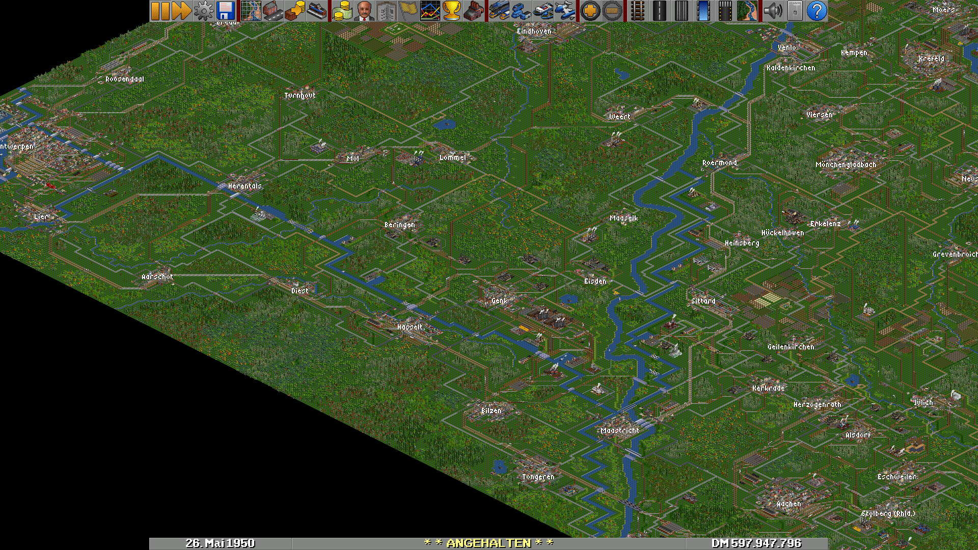
Don't want to hijack your thread but if you are interested in the adjacent parts of Germany I have all the lines down to rather small industrial railways from the Albertkanaal all the way eastward up to and beyond the Weser river and south along the Rhine down to Frankfurt with status approx. 1920-1950 in a heavily customized NRW scenario with XIS 0.6.2 as the industry set and a lot of extra towns added plus industries very close to their "real-world" positions. Very interesting area to play, lot of heavy industries unfortunately now gone, like De Staats Mijnen (DSM) and Eschweiler Bergwerksverein (EBV), see attached screenshot.
Let me know if a savegame would be of use to you - I spent almost a year to create all the lines, towns, and industries closely based on
openrailwaymap.org and wikipedia
Re: Virtual Netherlands
Posted: 19 Jun 2022 09:04
by bef123
Wow, a lot of great job done in your scenario. The area around Maastricht is in very far future for now cause I'm moving from the north to south with creating train schedule and detailing. Your map gives some good look with position of some cities and objects, but that area around Maastricht I have done already. Maybe in the future your scenario will help me in some way but now I'm focused in north and north-west Netherlands.
Cheers!
Re: Virtual Netherlands
Posted: 19 Jun 2022 12:19
by bef123
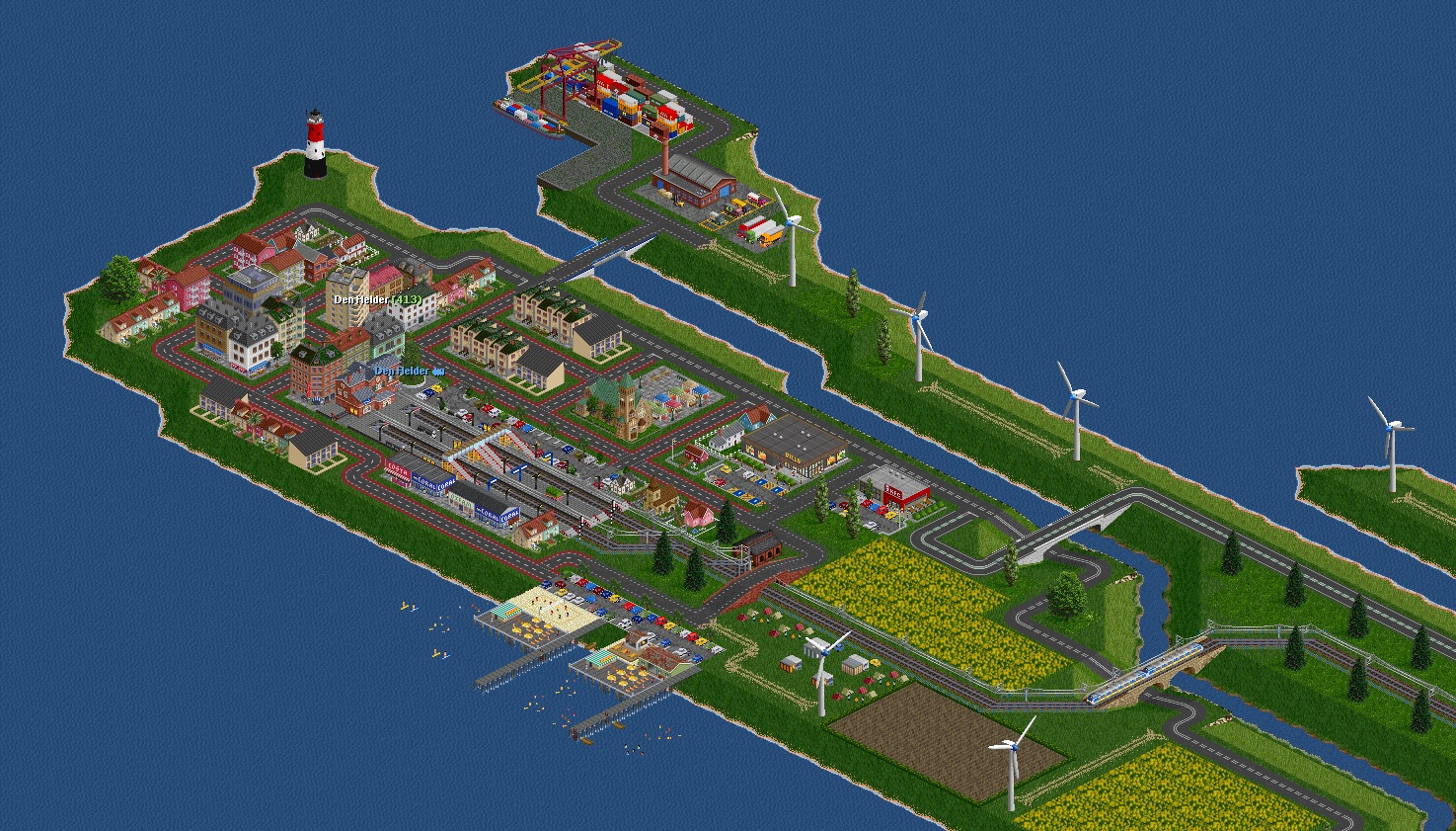
Today's screenshot represent my previous work from past few days. This is Den Helder on the headland far north from Amsterdam. Here the line from capital city ends. City has small harbour with some container tiles, harbour crane and small warehouse. A container ship has already dock for unloading. Tri-color lighthouse is leading ships to the port. To the south-west there is small beach with some piers, boats and small camping on the other site of the road. There's also big church and marketplace behind it, Billa shopping mall and KFC. Regional train is heading to the station through bridge over national road N9 and canal.
Re: Virtual Netherlands
Posted: 19 Jun 2022 13:36
by Quast65
But where is the Dutch Navy base?

Re: Virtual Netherlands
Posted: 19 Jun 2022 18:17
by bef123
Ups, my bad

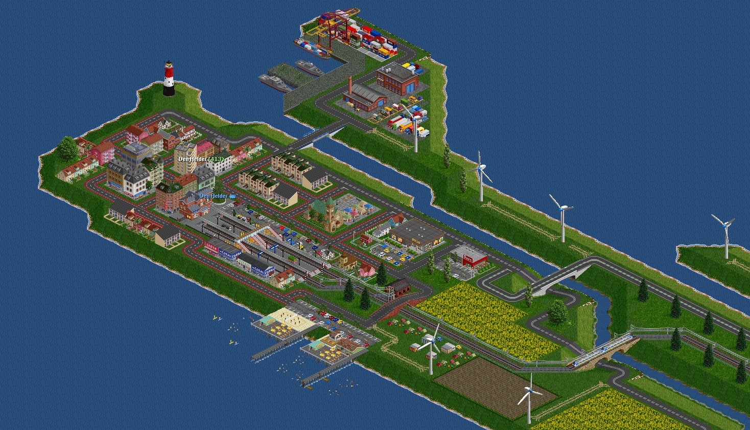
I didn't do accurate research of this area. Let me fix this. I'm posting another screenshot with updated Navy Base with battle ships.
Re: Virtual Netherlands
Posted: 19 Jun 2022 20:42
by Quast65
Hahaha, nice!!
Re: Virtual Netherlands
Posted: 19 Jun 2022 21:42
by bef123
Thanks
Re: Virtual Netherlands
Posted: 19 Jun 2022 22:19
by ebla71
bef123 wrote: ↑19 Jun 2022 18:17
Ups, my bad
I didn't do accurate research of this area. Let me fix this. I'm posting another screenshot with updated Navy Base with battle ships.
I also miss the ferry terminal. Went there several times with my parents as a kid to go to the island of Texel for holidays. Vividly remember a seemlingly endless beach and a little white booth in the dunes selling the possibly best fries in my life
Re: Virtual Netherlands
Posted: 19 Jun 2022 22:48
by bef123
That's a very nice memories of childhood
Unfortunately there isn't much space to fit everything

Re: Virtual Netherlands
Posted: 20 Jun 2022 00:44
by ebla71
bef123 wrote: ↑19 Jun 2022 22:48
That's a very nice memories of childhood
Unfortunately there isn't much space to fit everything
If I remember correctly (30+years ago) the ferry terminal was somewhere at the very far end, maybe left to the lighthouse, which is btw very nice - from which NewGRF set is this, looks different from the standard one?
You really spend a lot of time to fill the gaps in the landscape - normally my maps take so much time to set up the roads, railways, industries, and services that I can only customize a very small part of a town here or an industry there, usually close to where I live(d)
Re: Virtual Netherlands
Posted: 20 Jun 2022 08:12
by bef123
I always wanted to create full detailed map and Netherlands Map was the best for me to do it, mainly thanks to very flat terrain easy to fill every tile. Besides Netherlands has great rail network, I always wanted to recreatre it in virtual world.
The lighthouse indeed is from different set - Polish Lighthouse Set, it's lovely collection of mostly every more interesting lighhouse from whole polish Baltic coast.
Re: Virtual Netherlands
Posted: 20 Jun 2022 09:18
by bef123
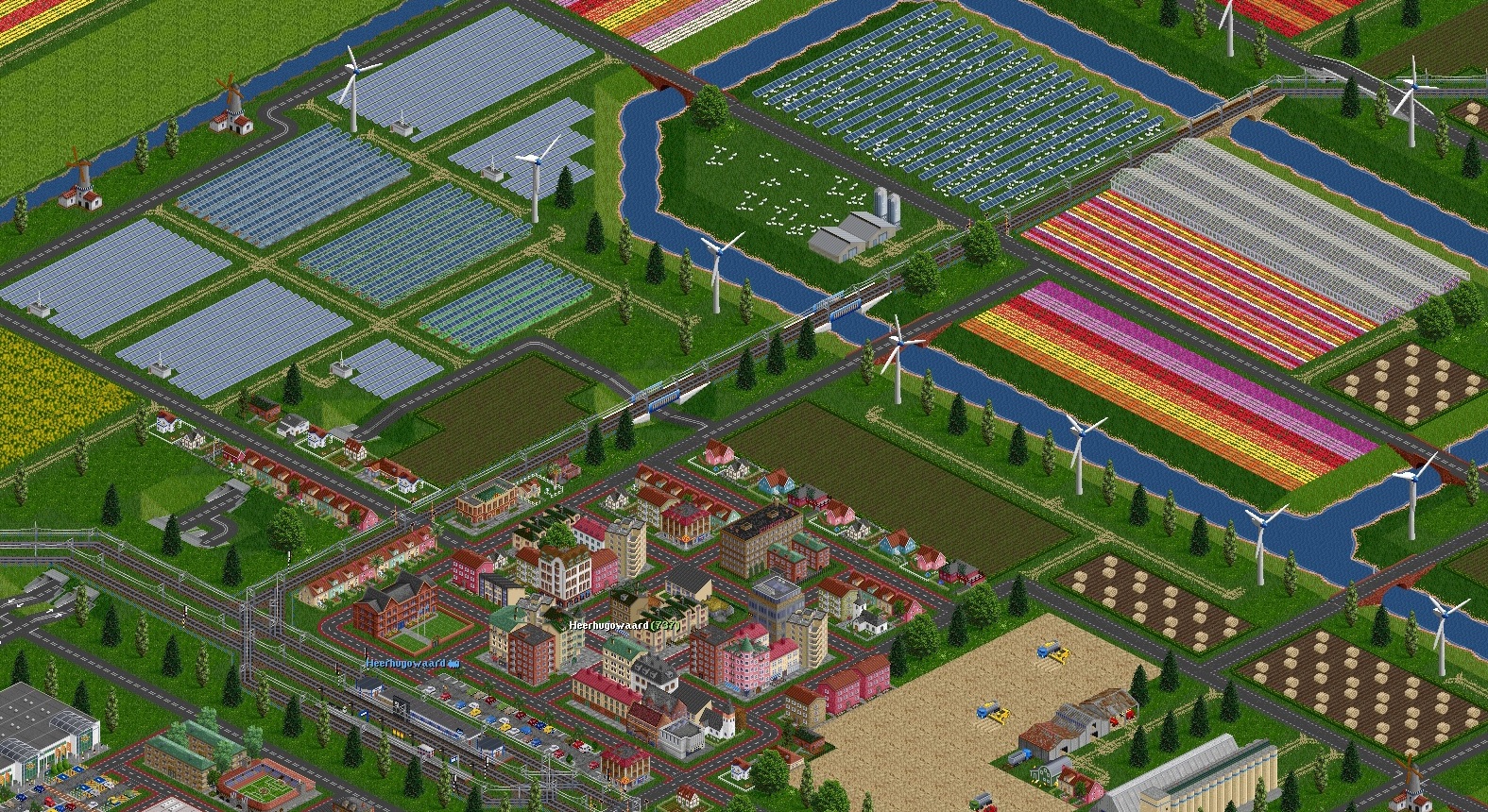
Area around Heerhugowaard with many solar farms and wind turbines gives green energy to the city. Here line splits to Den Helder and Hoorn. The N194 road is passing under the line. Many tulip colorful farms are visible around the city aswell the wheat farm to the south.
Re: Virtual Netherlands
Posted: 22 Jun 2022 10:15
by bef123
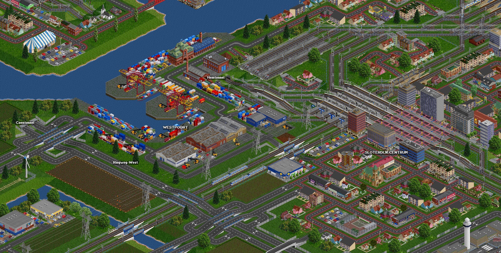
Ok now when I finished upper west area of map now it's time back to the south in the area of capital of Netherlands - Amsterdam. So next few posts will present different districts of this beautiful city.
First of them is showing west side of the city - Westpoort and Sloterdijk with A10 Ring-West highway. Also two underwater tunnels are visible, the highway Coentunnel and rail Hemtunnel under the Noordzeekanaal. Suburban duplex train station Amsterdam Sloterdijk is surrounded by high office buildings and is connecting many lines from different destinations, Haarlem, Hoofddorp and Zaandam. A little north is visible Lijnwerkplaats, a rail siding for trains ending routes from south and east of the country. Now it's empty cause these connection don't exist actually.
Re: Virtual Netherlands
Posted: 25 Jun 2022 10:54
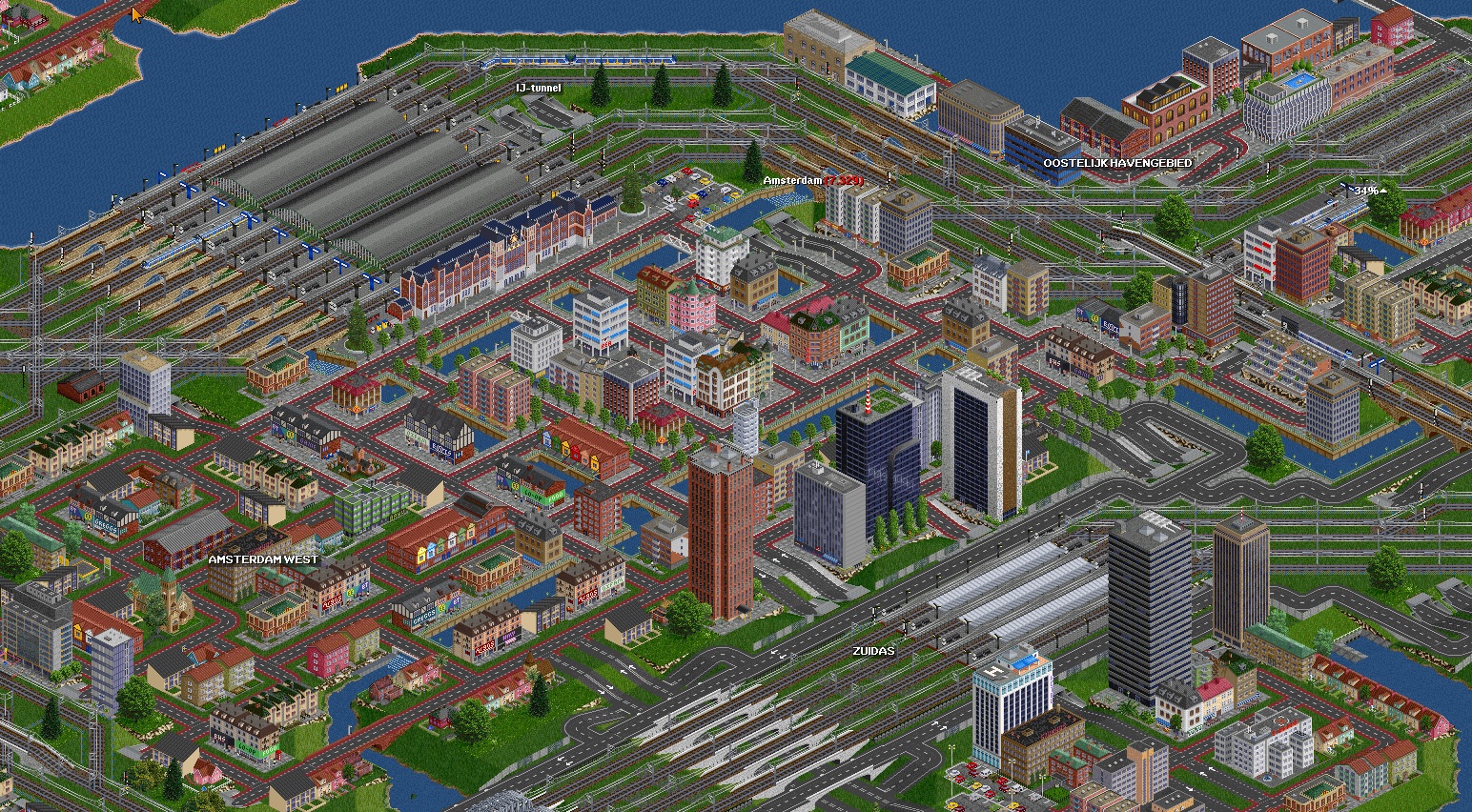
by bef123
It's time for center part of Amsterdam. Main station - Amsterdam CS has characteristic old classic facade and road IJ-tunnel below the platforms. Amsterdam West is residential suburban district. Zuidas to the south has second main station - Amsterdam Zuid with modern tall offices around. Here rail line is running between highway lanes of Ringweg-Zuid. To the east is old harbour-office district Oostelijk Havengebied.....ufff....thought name
Whole city is crossed by the canals.
Re: Virtual Netherlands
Posted: 27 Jun 2022 15:25
by bef123
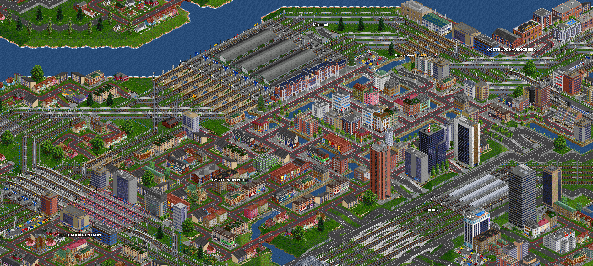
Overall view of Amsterdam and it's main districts.
Re: Virtual Netherlands
Posted: 29 Jun 2022 13:52
by bef123
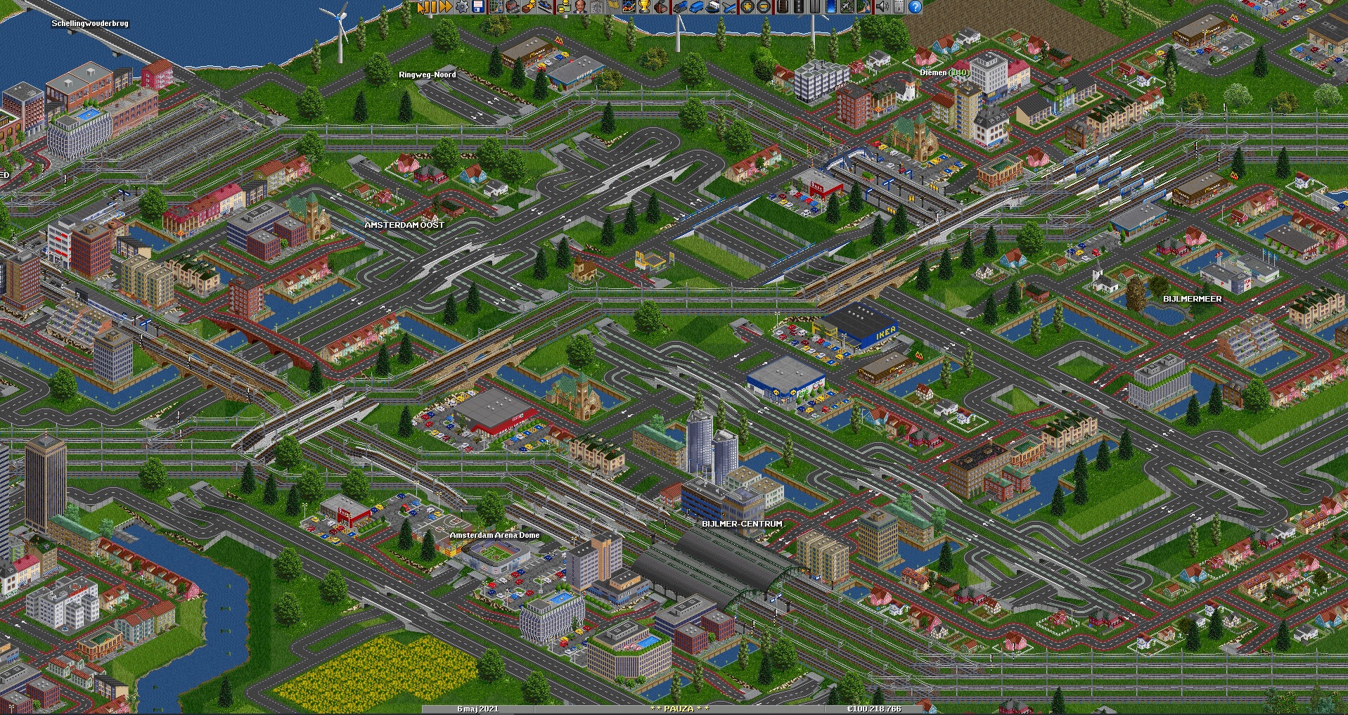
South-east districts of Amsterdam. With Bijlmer Arena rail station near Amsterdam Arena Dome Stadium and modern offices and hotels around. There's few rail lines that crosses these districts from different directions and going further to Amsterdam Central and Amsterdam South statoins. Highway Ringweg-Noord is passing city from the east and goes to the tunnel to the north part of the town.
Re: Virtual Netherlands
Posted: 05 Jul 2022 09:23
by bef123
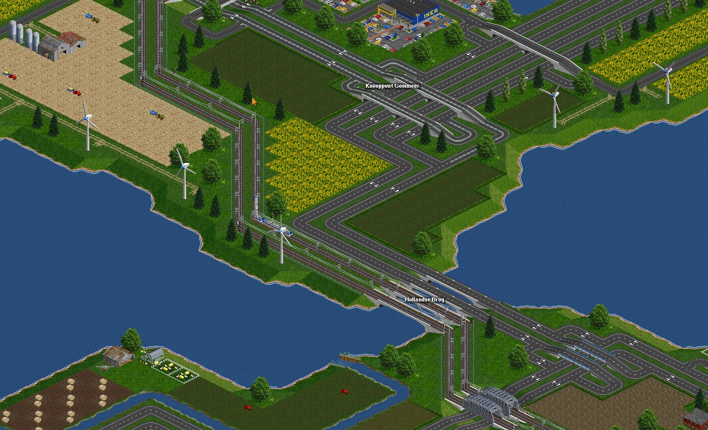
Let's get back to the east of Amsterdam where rail line divides in two directoins, east to Bussum and Hilversum and north to Almere and Lelystad. And now we will follow that second direction. North extension goes through Hollandsee Brug just by the A6 highway. This time in better resolution.
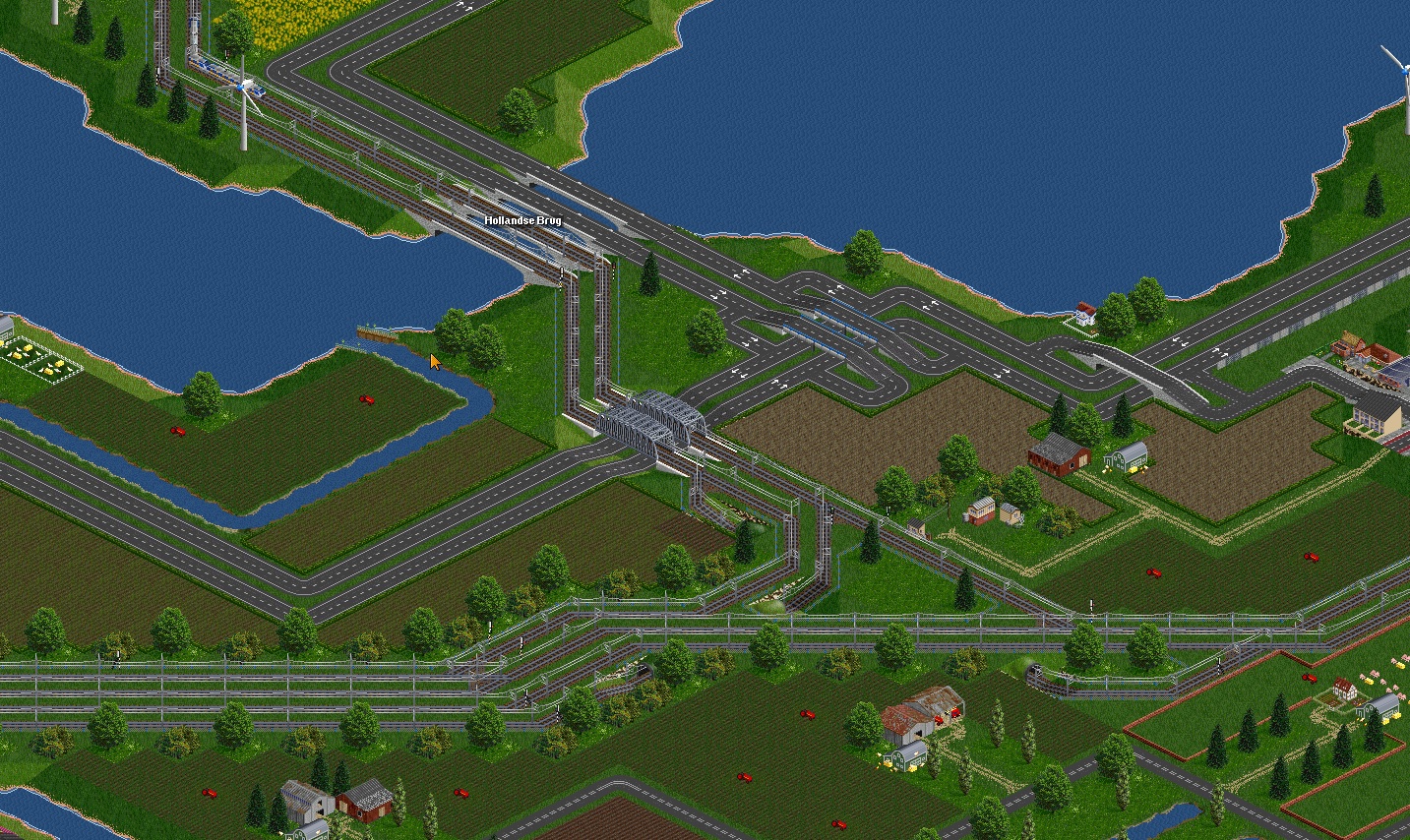
Just after the bridge track and highway are entering south suburbs of Almere.
Re: Virtual Netherlands
Posted: 07 Jul 2022 10:01
by bef123
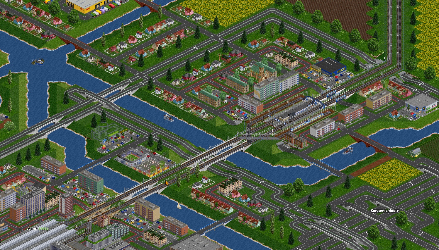
City of Almere with Weerwater lake. Highway A6 is running to the south and expressway N702 to the north of the city.
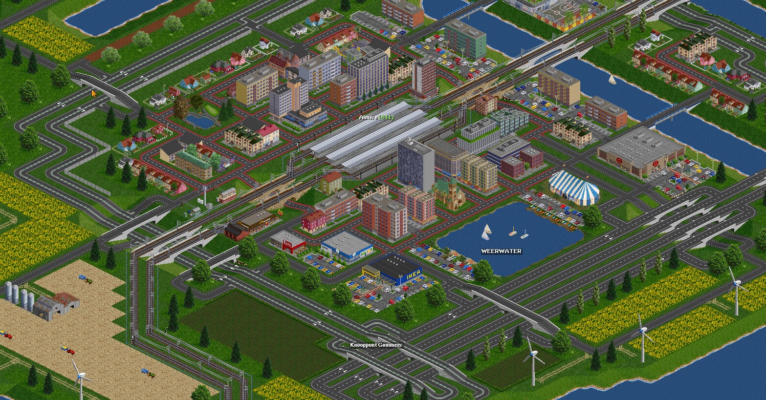
Two water reservoirs with hard names to wright it
Water locks allows sailing boats run between canals and Markermeer. Warehouse and retail area on the other site of water canal - Lage Vaart.
Almere Buiten - smaller part of the town to the west with suburban station and tracks for trains ending route in Almere.
Re: Virtual Netherlands
Posted: 10 Jul 2022 11:25
by bef123