
Credits
The heightmap for this scenario was based on the UK heightmap by JonScaife (source: NASA). See viewtopic.php?f=60&t=42124
This new scenario adds a lot of new details and is more realistically proportioned compared to the original TTD Scotland
Compare the minimap of the original (left) with the new map (right)

The original TTD scenario seems to have been drawn by hand in a time when digital heightmaps were not so common. It's amazing to see so many details were right!
This is not an exact copy of a heightmap
A lot of work went in making details look better.
- Most obvious is that I rotated heightmap so that it aligns the Great Glen east-west, like in the original scenario. The cut was made to be similar to the original.
- I decided to emphasise many valleys that in the real world feature important railway connections.
- I'm also aware that mountains will not have the right height - for example, the highest mountain of the UK is Ben Nevis. Due to the small size of the map and the fixed slopes, it is not the highest mountain in this map
 .
. - Extra effort was also put in making the islands actually islands.
- A bit of cheating was done with rivers and some of the lakes, that are often not at sea level, for example Loch Ness, Loch Tay, the Tay River, the Forth River, and a few more. This is the approach I copied from the original TTD scenario.
- Towns were placed by hand, and I added (compared to the original) a variety of little towns and cities to the map.
- Near Stirling I removed three cities that were present in the original game: Grangemouth, Alloa and Dunblane, as things were just getting too cramped when playing.
- Transmitters were added to certain hills, and lighthouses were added strategically along the coastline.

Relief map in OpenTTD with town names (Click here for the map without town names at Flickr)

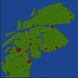
Overview of the industries

Screenshot of the original TTD map (Zoom in at Flickr)

Screenshot of the new Scotland scenario (Zoom in at Flickr)

License
Licensed as: CC-BY-SA v3.0.